3D beach map may help kids connect with nature

 Durham Wildlife Trust
A 3D coastal map may helpautistic children connect with nature, a conservation charity said.
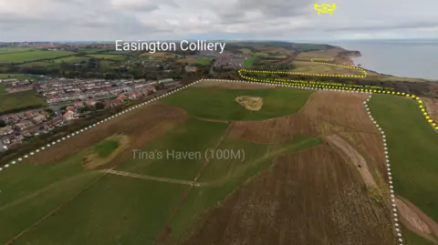
Durham Heritage Coast Partnership, which is made up of local councils and organisations such as the Durham Wildlife Trust,has produced a virtual map of the county's coastline from Seaham to Crimdon.
Official Michael Burn said thepartnership was taking the map into schools and it could be useful for children with autism who had not been to the coast and felt hesitant to visit.
He alsosaid showing residents the map gave them a "feeling of already being there" and connecting with nature made them "want to protect it".
The map can be seen from either a 25m (82ft) or 100m (328ft) birds eye view.
At the closer range, viewers are given information about current and past conservationwork on the land, Burn said.
 Durham Wildlife Trust
He said the map was "an educational tool to make residents proud of the region they live in".
He said most people knew about the area's mining legacy but less was known about the work done to restore the landscape since.
"It's been a really nice way to celebrate the work we've done but it's also about pulling people in, and I think that's where it's going to get the most mileage," he said.
"If people can have that connection to it [nature], then they want to protect it and then they have a passion about it."
